

Pour le compte du BRGM, NOT Engineers est intervenu pour effectuer le relevé par scanner 3D de galeries d’anciennes mines abandonnées, contrôler et mesurer les fontis, et recaler la topographie par (...)
Old mines and abandoned quarries
(note: this is an automated translation)
The forgotten or abandoned mines or underground quarries can be an major geological hazard, occuring as an unpredictable risk of sinkhole collapse for example. These old farms or underground refuge and other tunnels are also often a neglected rich heritage.
At NOT Engineers, are are a team of professionnal speleologists and a geologist, able to work with you in dealing with this issue, whether in emergency response on long-term management.
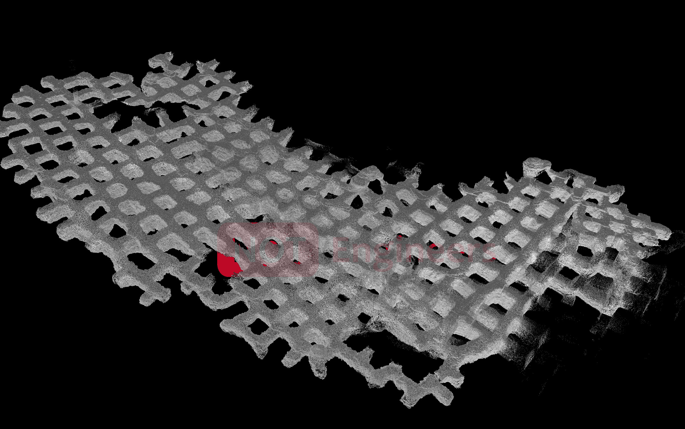
3D survey of an underground quarry
3D survey of an underground room and pillar quarry. More than 140 pillars, 7.4 acres, 7ft pillars
NOT Engineers - Olivier Testa
Examples of our work
- Geophysical prospection,
- Petrology
- Cartopgraphy of cracks, fault directions
- Establishment of geological sections
- Location of mineralized veins
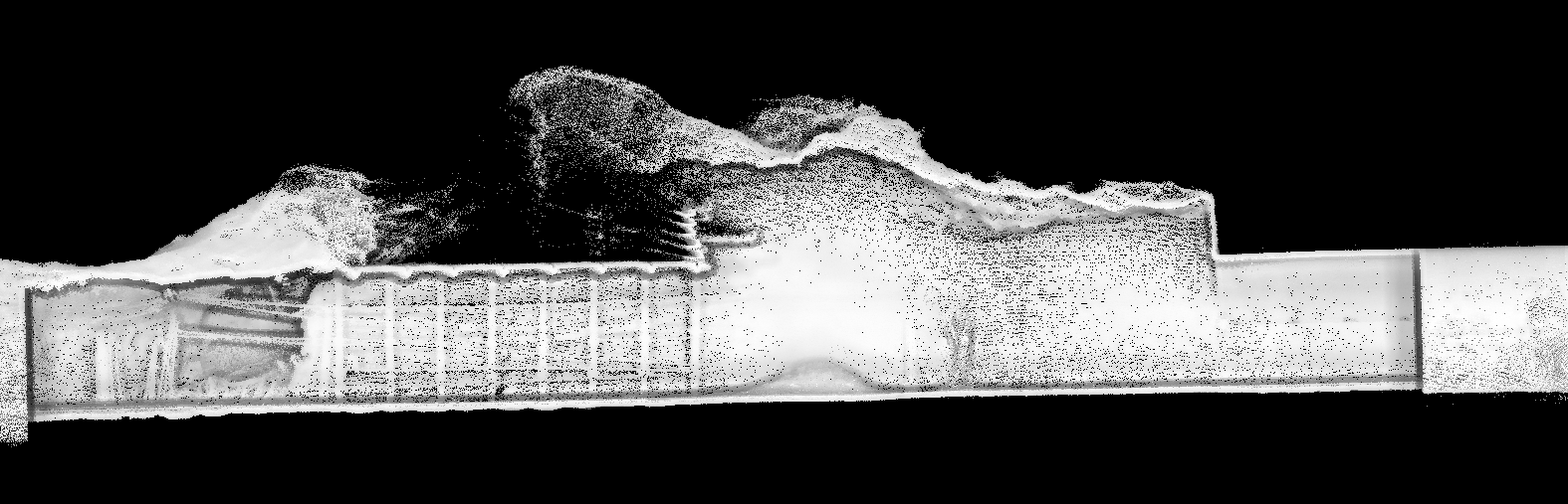
Suivi d’effondrement - vue en coupe
On voit le confortement construit par l’exploitant de la mine. Il est possible de mesurer le vide qui reste au dessus.
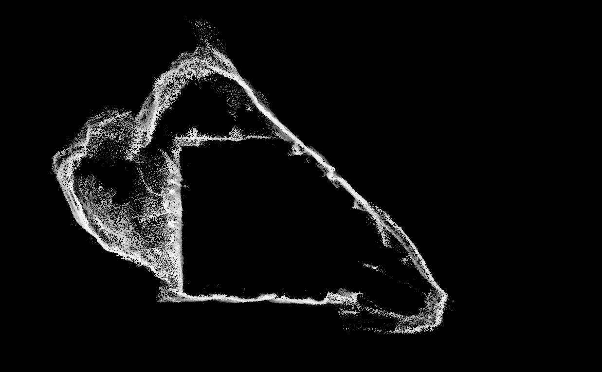
Suivi d’effondrement - Coupe transversale
L’exploitant a réalisé un confortement bétonné de section carré. On voit sur cette vue l’emprise de l’effondrement en cours au delà.
- Exploration and monitoring of abandoned cavities
- Topographic survey
- instrumentation
- Even in narrow passages (up to 0.40m)
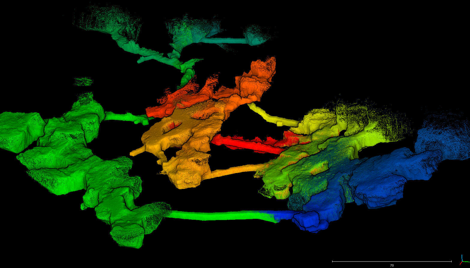
Topographie 3D d’une ancienne carrière souterraine
3 exploitations distinctes visibles sur cette vue. 3 bancs de calcaires ont été exploités sur 10-15m d’épaisseur. Galeries de jonction (rails)
NOT Engineers
- Cartography
- Identification of all geomorphological features
- Collapses
- Geology
- Anthropogenic elements
- GIS or map output
Related projects :
Topographie d’anciennes galeries de mine Scan 3D de la carrière médiévale sous l’hôpital Cochin Modélisation et topographie 3D de la carrière sous Cochin, un réseau souterrain contigu aux catacombes de Paris.
Topography and cave surveying Production of a full set of underground cave topographies of caves, for an environmental study related to the opening of a quarry in Gabon.
Topographie souterraine d’une mine Levé de topographie d’une mine souterraine - nos prestations