

30 human skeletons, weapons, tools, jewelery, pearls ... In 2018, Irougou cave in Gabon has revealed exceptional archaeological remains
Cave Surveying
We do cave surveying in natural networks (caves and chasms survey) or artificial (quarries, tunnels), difficult to access, or when a total station / theodolite is not suitable.
We work alone or in support of your team of surveyors if necessary, in difficult access areas or complex sites.
Underground topography can take a very long time, according to the difficulties of access and progression, the required accuracy, the desired level of detail and the end use. Depending on the conditions and the level of detail, we can survey between 200m and 2000m of underground galleries per day.
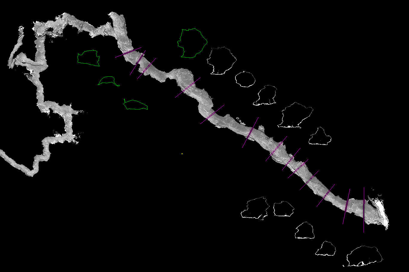
Topo 3D de grotte
les sections de la galerie principale ont été déportées
NOT Engineers
That is why we will define together the different element to establish for the quotation.
- Topography of underground places
- Surveying and mapping of caves, underground quarries
- Gallery and small diameter conduits
- Access guarding, rope descent on
- 2D / 3D surveying
- High resolution 3D scanning of caves for 3D modeling
- Underground positioning relative to the surface of caves (up to 300m deep with our electromagnetic radiolocation beacon)
- Mapping
- Landslides, pillars, arches
- Presence of water, sediment, fracturing
- Stratigraphic section
- Scanned data, rendering GIS, integration of georeferenced layers,

Vue carrière 3D en coupe
Le bonhomme (au bout de la flèche) donne l’échelle. Pour des carrières si vastes, où le sol est recouvert de déblais d’exploitation, certaines informations (fracturation, pendages) se voient au plafond, qui est haut et invisible. Notre modèle permet de prendre ces mesures.
NOT Engineers
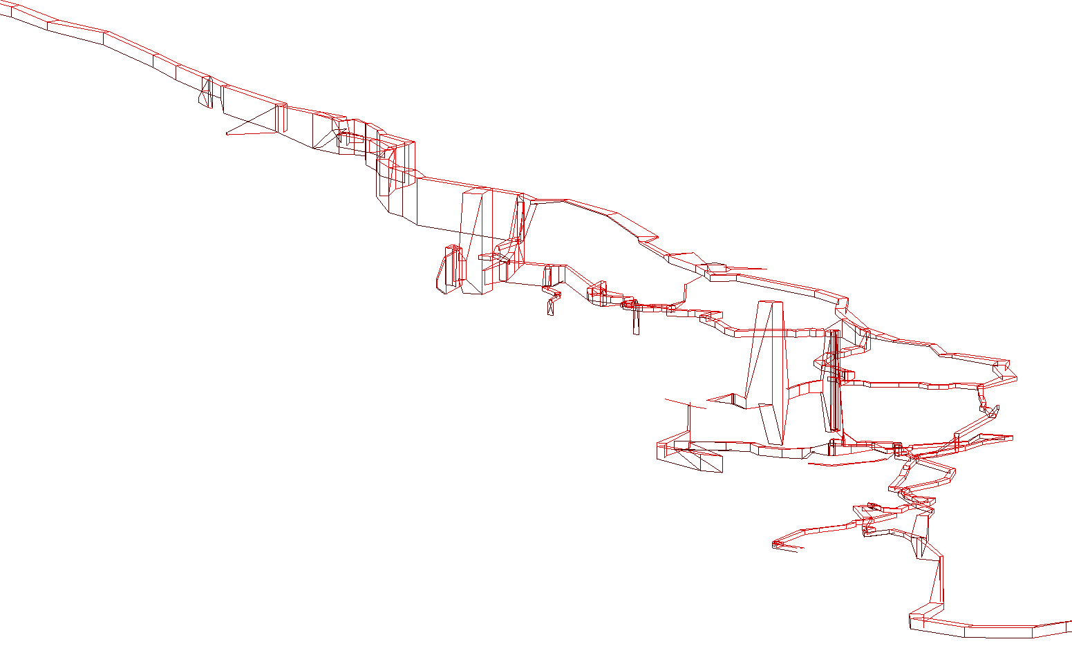
View of a very simple 3D model of a cave
The gallery represented here is 500m long. Data were taken with a handheld laser survey equipment
Planimetric map of a mine over a cadastral plan
(note: data have been altered for confidentiality)
Related projects :
Discovery of Iroungou cave, an exceptional burial site in Gabon Topography and cave surveying Production of a full set of underground cave topographies of caves, for an environmental study related to the opening of a quarry in Gabon.
Topographie du réseau souterrain des vieux tunnels de Dumat al-Jandal Mission archéologique pour étudier les vieux souterrains de Dumat, Arabie Saoudite
Carte topographique et réalisation d’un modèle numérique de terrain Au Congo, NOT Engineers a réalisé pour un projet archéologique une cartographie avec modèle numérique de terrain.
Speleological research in the caves of Lastoursville - Gabon Third mission in the caves of Lastoursville (Gabon) for NOT Engineers, on a contract with the Gabon National Parks Agency, from july 4th to 25th
Prospection, cartography, underground survey and (...)Scan 3D de la carrière médiévale sous l’hôpital Cochin Modélisation et topographie 3D de la carrière sous Cochin, un réseau souterrain contigu aux catacombes de Paris.
Topographie d’anciennes galeries de mine Pour le compte du BRGM, NOT Engineers est intervenu pour effectuer le relevé par scanner 3D de galeries d’anciennes mines abandonnées, contrôler et mesurer les fontis, et recaler la topographie par (...)
Karst hazard assessment under a road Exploration of karst cavities for karst hazard
Topographie souterraine d’une mine Levé de topographie d’une mine souterraine - nos prestations